English
  Français
  العربية

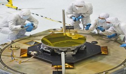
A Clear Reflection on Webb Telescope’s Secondary Mirror
The sole secondary mirror and another primary mirror that will fly aboard NASA’s James Webb Space Telescope arrived at NASA’s Goddard Space Flight Center in Greenbelt, Md., on Nov....