ملخص
تشهد المجتمعات الإنسانية مع بداية الألفية الثالثة ثورة هائلة في المعلومات الجغرافية ، والتي أتاحت للإنسان الفرصة في إدارة العديد من الظاهرات الجغرافية بتوقعها وتوجيهها لخدمة المجتمع ، الأمر الذي جعل من هذه المعلومات مطلباً لاغنى عنه للحياة البشرية ولبقاء الإنسان ورفاهيته .
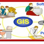
لذا سعى المهتمون بتدريس الجغرافيا إلى البحث عن استراتيجيات وأساليب تدريسية تتناسب والتقدم العلمي الهائل في المعلومات الجغرافية من ناحية والتطورات التكنولوجية الحديثة من ناحية أخرى ، وتُعد نظم المعلومات الجغرافية والمعروفة بـ GIS إحدى أهم الاستراتيجيات والأساليب التدريسية التي تم التوصل إليها ، حيث يمكن توظيفها في إعداد وتنظيم المقررات الجغرافية بما يتناسب مع فلسفتها وأهدافها ، وذلك لأنها تمتلك القدرة على تخزين و استكشاف وتحليل البيانات المكانية بسرعة ودقة فائقة و إصدار قرارات سليمة بشأن ترشيد استخدام واستثمار الموارد الطبيعية والبشرية المتاحة ، وبما يتناسب مع فلسفة وأهداف العلوم الجغرافية ، ويمثل استخدامها كتقنية حديثة أحد متطلبات سوق العمل لخريجي أقسام وشعب الجغرافيا .
من هنا تم القيام بتكثيف وزيادة الإطلاع على انواع واقسام علم الجغرافيا وبالاخص في مجال نظم المعلومات الجغرافية للتعرف على المزيد عن كيفية توظيفها والاستفادة منها في تعليم وتعلم الجغرافيا ، كتقنية ، ومفهوم ، ومكونات ، وأهمية توظيفها في دراسة المقررات الجغرافية من ناحية ، واستخدامها في دراسة الظاهرات الطبيعية والبشرية المحيطة من ناحيةأخرى .
Abstract
Witnessing human societies with the beginning of the third millennium huge revolution in the geographic information, which allowed for a person the opportunity to manage many of the phenomena of geographical with directed to serve the community, which made this information requirement indispensable for human life and human survival and well-being So the interested in teaching geography went to search for strategies and teaching methods suited to scientific huge progress geographic information on the one hand and the recent technological developments on the other hand, is the geographic information systems, known as GIS one of the most important strategies and methods faculty reached, where it can be employed in the preparation and organization geographical Courses sutapuil with the philosophy and objectives, and that they possess the ability to store and explore and analyze spatial data quickly and accurately speed and issuing sound decisions on the rationalization of the use and investment of natural resources and human resources, and in line with the philosophy and goals of science and geography, and represents use technique modern one market requirements work for graduates of departments and people of geography.
From here has been done to intensify and increase access to types and sections of geography, especially in the field of geographic information systems to learn more about how to employ them and benefit from them in the teaching and learning of geography, technique, and the concept, and components, and the importance of employing the study courses geographical terms, and used to study the phenomena .
الكاتب
الدكتورة خلود عبدالخالق السالم
Personal details:
Nationality: Iraqi
Qualifications:
- 1972- 1976 ----Bachelor of statistic Science in administration & economecAL COLLEGE / STATISTIC SCIENCE / Baghdad University
- MASTER OF URBAN TOWN PLANNING / BAGHDAD UNIVERSITY
- COMPUTER CENTER – BAGHDAD UNIVERSITY
- 1. Microsoft Office Word
- 2. Microsoft Office Excel
- 3. Microsoft Office PowerPoint
- Microsoft Office Access
Professional Experience:
- 1978-1988 worked in Nuclear Energy Authority as employ in Department of Administrative
- 2005 – 2010 worked in SCIENCE AND INFORMAITION TECHNOLOGY MINISTRY.
- 2010 Ministry of Higher Education and Scientific Reserargh-University of Kufa- Faculty of physical planning as lecturer
Searches
A thesis
"Technical Construction Database of Urban Planning for Baghdad City \ The Case Study Developing city Center Of KADHMIA "
Another Searches:
- The effects of electronic governments (EC)on modern life .2006
- Technology of electronic planning programs. 2006
- Kinds of environmental pollutions .2007-2009
- The effects of environmental psychology on old cities population.2007
- The earliest technology in urban town planning systems and how it's used. 2007-2009
- Different kinds of database and it's benefits .2007
- The environmental impact on urban planning 2011
- Anthropology ancient city 2012
languages:
- Arabic (native)
- English
 English
  Français
  العربية


