News

11 November 2012

RIEGL launches VZ-6000 Terrestrial Laser Scanner


RIEGL goes for ultra-long ranges: VZ-6000 offers more than 6,000 m measurement range

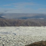
Horn, Austria, September 24, 2012 – Especially designed for ultra-long range applications in topography and mining, the new High-Speed, High-Accuracy Terrestrial Laser Scanner RIEGL VZ-6000 offers ultra-long measurement range of more than 6,000 m for static applications. As the Laser Class 3B companion of the RIEGL VZ-4000, it is due to its laser wavelength exceptionally well suited for measuring snowy and icy terrain in glacier mapping, monitoring & surveying missions, as well as for specific applications in open pit mining. First fieldwork in Greenland this month exceeded all expectations.

Combined with the innovative RIEGL software package RiMINING, both, the VZ-4000 and the VZ-6000, offer an optimized and simplified data registration and processing workflow for surveying of extended areas. E.g., automatic extraction of break lines, contours, profiles and calculation of volumes make for more efficiency in the demanding open-pit mining fieldwork.

Experience the revolutionizing RIEGL mining solutions at MINExpo 2012 from September 24 -26, 2012 in Las Vegas at the RIEGL USA booth #5903. Our team looks forward to meeting you!


1320_effects-image

Precision Technologies Role in the Study of Climate Change Impact

The Second session of the International Symposium Precision Technologies Role in the Study of Climate Change Impact and its implications on the Economic and Natural Structure: The reality and suggested solutions Istanbul, Turke...
by Lamouchi Helmi
0


f0ecbd2a-2ed9-458d-91ab-07e1caedea10-9867cc4df536.small

5th International Conference on Water, Energy, Food and Agricultural Technology Istanbul, Turkey, 22-25 January 2019

5th International Conference on Water, Energy, Food and Agricultural Technology Istanbul, Turkey, 22-25 January 2019   Scientific themes 1-      water resources and desertification and agricultural techniques 2-   ...
by Lamouchi Helmi
0


geotunis-2016-banniere

10th edition of the International Congress & technologies dedicated to geospatial applications

The Geographic Information Systems and Geospace Data for sustainable development                              Under the slogan                                    Role of GIS appl...
by Lamouchi Helmi
0


FORMATION-11-BD

Information Technology Infrastructure Library

Information Technology Infrastructure Library ITIL Oldo-lina Foundation for the French East development in collaboration with the Euro-Arab union Geomatics organizes training for IT Service Management ITIL V3 Will be held in Ly...
by Lamouchi Helmi
0


image_42

WEAP’s new version is launched

WEAP (Water Evolution and Planning) has been looking for solutions to preserve fresh water and developing strategies to live within certain water budget in a sustainable manner. WEAP’s teamwork is working in almost all over t...
by Lamouchi Helmi
0


Untitled-1

Signing a collaboration protocol between the Euro-Arab Union of Geomatics and the Arab Union of Survey

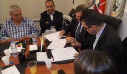
A collaboration protocol was signed on Wednesday morning May 15,2013 inthe Euro-Arab Union of geomatics office inBeirut,Lebanon. The protocol states the technical and scientific cooperation between academics and professionals i...
by Lamouchi Helmi
0


DSC_0391

7th edition of Geotunis closes its activities and announces its recommendations

The 7th edition of the international congress Geotunis which was opened on April 8 closed its activities on Friday, April 12 2013. The congress gathered the academic, training and investment aspects thanks to the remarkable int...
by Lamouchi Helmi
0


DSC5

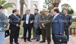
Tunisian security institution participates in the activities of the 7th edition of Geotunis

Regarding the importance of geographic information in the improving the security performance, the Tunisian security institution participated in the 7th edition of Geotunis, which was held in Hammamet 8- 12 April 2013. A study d...
by Lamouchi Helmi
0


DSC_0226

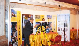
Trimble participates in the 7th edition of geotunis

 The international Trimble company, specialized in the production of positioning via satellite devises, surveying techniques and mapping, participated in the 7th edition of geotunis, where it presented its latest techniques in...
by Lamouchi Helmi
0


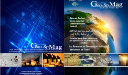
couverture-recto-verso-magazine

The publication of the first edition of GeoSP

The first edition of GeoSP was published in April. The edition includes several researches and good quality studies which was presented to international arbitration. The first edition includes an interview with the president of...
by Lamouchi Helmi
0


DSC_0120

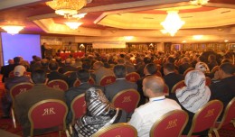
Remarkable Arab and African participation in the 7th edition of the international congress Geotunis

Arab and African participation in the 7th edition of Geotunis held between April 8-12 2013 in the Royal Resort hotel, Hammamet in the presence of experts, specialists, scientists, representatives of ministries, companies and pe...
by Lamouchi Helmi
0


petrole_essence_cour_cours_baril_russie_georgie_caucase_oleoduc

The interest of petroleum and energy institution in the 7th edition of Geotunis

The 7th edition of geotunis which closed on April 12, 2013 in hammamet, drew the attention of international companies known in the oil sector, such as Shell, Tunisian Company of Petroleum Activities, Iraqi Oil Institution and o...
by Lamouchi Helmi
0


0 comments »


Be the first to comment!


Leave a Reply

Your email address will not be published. Required fields are marked *

*

* Copy This Password *

* Type Or Paste Password Here *

You may use these HTML tags and attributes: <a href="" title=""> <abbr title=""> <acronym title=""> <b> <blockquote cite=""> <cite> <code> <del datetime=""> <em> <i> <q cite=""> <strike> <strong>