RICHMOND HILL, Ontario, Canada, May 03, 2013 – PCI Geomatics, a world-leading developer of remote sensing and photogrammetric software and systems, announced today that it now supports KOMPSAT-3 imagery within its software suite.
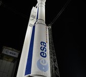
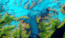
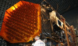
KOMPSAT-3, a new satellite built and operated by the Korean Aerospace Research Institute (KARI) was launched on May 12th, 2012 from the Tanegashima Space Center of the Japan Aerospace Exploration Agency (JAXA), Japan. KOMPSAT-3 is an optical imaging satellite capable of imaging the Earth with a resolution of 0.70 m Panchromatic and 2.8 m Multispectral (Blue, Green, Red, Near-IR). KOMPSAT-3 includes the Advanced Earth Imaging Sensor System (AEISS), which is a high-resolution imager (Pan and MS). This prime instrument of the mission was developed by KARI.
“We are very pleased with the great effort of PCI Geomatics,” said Dr. TaeByeong CHAE, Head of the Satellite information Proliferation Team at KARI. “With this new and improved solution, KOMPSAT-3 images will be more easily accessible and useful to the public and commercial users around the globe,” he added.
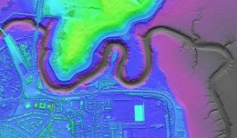
“We have worked closely with KARI to validate our software’s support for KOMPSAT-3 imagery,” said Dr. Philip Cheng, Senior Scientist at PCI Geomatics. “Our software includes support for the new Single Pass Stereo Mode, which will be capable of extracting high-resolution DEMs. Users of our software will also have the ability to pansharpen KOMPSAT-3 imagery.”
PCI has performed quality control on the imagery to determine the achievable accuracy, and found the correction of the KOMPSAT-3 imagery to be very accurate using the Rational Polynomial Coefficients (RPC) provided. The support for KOMPSAT-3 will be available in a future service pack for Geomatica 2013 and can be deployed now in PCI’s enterprise-level production systems.
PCI’s support for KOMPSAT-3 will include RPC model creation and the Toutin Model (allowing for very accurate corrections using the satellite orbital ephemeris data) as well as rapid and high-quality pansharpening capability. KOMPSAT-3 images have been provided by Satrec Initiative, which holds the exclusive right for global distribution right for the KOMPSAT series of satellites.
For more information on PCI’s support for KOMPSAT-3 and processing capabilities that are available within Geomatica 2013, visit:www.pcigeomatics.com/products/geomatica-2013
About the Korea AeroSpace Research Institute (KARI)
Established in 1989, KARI is devoted to its role as the leading aerospace research and development institute in Korea. KOMPSAT-2 was successfully launched on July 28th 2006 and recently KOMPSAT-3, the latest satellite of KOMPSAT series, was launched on May 18th 2012. KARI is now developing KOMPSAT-3A and KOMPSAT-5 in an effort to expand Korea’s national space development program. The goal of KARI is to establish a 24-hour satellite observation system surrounding the Korean Peninsula through the KOMPSAT series. Find out more about KARI at www.kari.re.kr/eng/
About the Satrec Initiative
Satrec Initiative (SI) is the leading solution provider for Earth observation missions, offering customers worldwide high performance, cost-effective turnkey satellite platforms, electro-optical instruments, ground systems and components. Focusing on the customers’ needs with innovative technologies, SI has delivered optimized high quality solutions to over 20 customers in the Middle East, Asia and Europe. Si has exclusive sales right of Kompsat 2, 3 and 5. Find out more about Satrec Initiative at www.satreci.com/eng/
About PCI Geomatics
PCI Geomatics is a world-leading developer of software and systems for remote sensing, imagery processing, and photogrammetry. With more than 30 years of experience in the geospatial industry, PCI is recognized globally for its excellence in providing software for accurately and rapidly processing both satellite and aerial imagery. PCI has installed more than 30 thousand licenses, in over 150 countries worldwide. Find out more about PCI Geomatics atwww.pcigeomatics.com.
 English
  Français
  العربية


