Articles and Interviews

12 August 2024

Geo-spMag Journal Achieves Impact Factor of 1.943 in ISI Indexing

Geo-spMag Journal Achieves Impact Factor of 1.943 in ISI Indexing

In a significant milestone for Arab scientific publishing, the international peer-reviewed journal “Geo-spMag,” published by the Tunisian Association for Digital Geographic Information (ATIGED), has achieved an impressive impact factor of 1.943 within the International Scientific Indexing (ISI) databases.

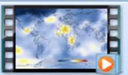
Geo-spMag stands as one of the pioneering Arab journals dedicated to applied geography sciences and geomatics. It provides an essential platform for researchers and academics to publish their work in these rapidly growing fields.

Founded with the mission to enhance scientific exchange and elevate research standards in applied geography and geomatics technologies, the journal has gained widespread recognition for the quality of its published articles and the rigorous standards it maintains in scientific publishing.

The Tunisian Association for Digital Geographic Information, which oversees the journal, is committed to fostering innovation and development in the fields of digital geography and promoting scientific research among scholars in the Arab world and globally.

This achievement strengthens the journal’s position as a key player in the field of applied geography sciences and contributes to elevating the status of Arab scientific research on both local and international stages.


1595_481137111962333_1750011374_n

Bluesky’s LiDAR experts educate Mouchel’s water industry professionals

The Mouchel Urban Drainage Academy (MUDA) trains water industry professionals Aerial mapping company Bluesky is helping water industry professionals understand the potential of laser captured height models. Following a request ...
by Lamouchi Helmi
0


Pict1_working meeting

Creation of a digital 3-dimensional model

TogliattiKauchuk Plant – Togliatti, Russia  Laser scanning as a method of storage of spatial information is used in various economic sectors. In this article, we will focus on laser scanning for industrial design, or more pr...
by Lamouchi Helmi
0


p3-gulfstream

AeroMetric Announces New High Accuracy Mapping Solution

Sheboygan, Wisconsin, May 23, 2013 – AeroMetric announced the addition of a new High Accuracy Mapping Solution for its clients. The new solution is designed to obtain tight vertical accuracy and highly detailed imagery...
by Lamouchi Helmi
0


téléchargement

Learn to Use Esri’s Collector for ArcGIS on Your Smartphone

You can work with maps in the field using Esri’s Collector for ArcGIS app on your iPhone or Android smartphone. You can also use maps to capture spatial and tabular data with the phone’s GPS or by tapping on the map...
by Lamouchi Helmi
0


VV02 retrait portique

ESA’S VEGA LAUNCHER SCORES NEW SUCCESS WITH PROBA-V

The second flight of ESA’s newest launch vehicle has been completed from Europe’s Spaceport in Kourou, French Guiana. Two Earth observation satellites, ESA’s Proba-V and Vietnam’s VNREDSat‑1A, were released into diffe...
by Lamouchi Helmi
0


19860728

New Public Application of Landsat Images Released

Google released more than a quarter-century of images of Earth taken from space Thursday compiled into an interactive time-lapse experience. Working with data from the Landsat Program managed by the U.S. Geological Survey, the ...
by Lamouchi Helmi
0


746080main1_Graham_latest_226

NASA and Amateur Radio Operators Piece Together the PhoneSat Picture

Although the ultimate goal of the PhoneSat mission was to determine whether a consumer-grade smartphone can be used as the main flight avionics for a satellite in space, the three miniature satellites (named Alexander, Graham a...
by Lamouchi Helmi
0


1367507172iPad5

Google Maps for iPad Has Mileage with Latest EggMaps Update

PERTH, Australia, May 6, 2013 — (PRNewswire) —  Mike Cunneen today announces EggMaps HD 1.05, an update to his popular #1-ranked navigation app for iPad that provides Google Maps at full-screen high resolution. Version 1....
by Lamouchi Helmi
0


images

PCI Geomatics Software Supports KOMPSAT-3 Sensor

RICHMOND HILL, Ontario, Canada, May 03, 2013 – PCI Geomatics, a world-leading developer of remote sensing and photogrammetric software and systems, announced today that it now supports KOMPSAT-3 imagery within its softwa...
by Lamouchi Helmi
0


3DLaserScanning_1

History in 3D

Time travel to the past or to the future has always been the dream of humanity. We have always imagined life in the past or the future, but what would it be like if we walked around in the city Paris of 2000 years ago though a ...
by Lamouchi Helmi
0


DSC_01551

Minister of communication and Information Technologies opens the activities of the 7th edition of Geotunis

Dr. Monji Marzouk, Minister of communication and Information Technologies opened on Monday, April 8 2013 the activities of the 7th edition of the international congress geotunis held under the slogan: Through geographic infrast...
by Lamouchi Helmi
0


Untitled-2

NASA Finds 2012 Sustained Long-Term Climate Warming Trend

NASA scientists say 2012 was the ninth warmest of any year since 1880, continuing a long-term trend of rising global temperatures. With the exception of 1998, the nine warmest years in the 132-year record all have occurred sinc...
by Lamouchi Helmi
0


0 comments »


Be the first to comment!


Leave a Reply

Your email address will not be published. Required fields are marked *

*

* Copy This Password *

* Type Or Paste Password Here *

You may use these HTML tags and attributes: <a href="" title=""> <abbr title=""> <acronym title=""> <b> <blockquote cite=""> <cite> <code> <del datetime=""> <em> <i> <q cite=""> <strike> <strong>