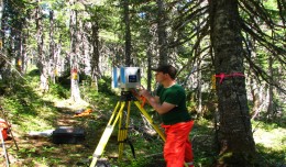
18 December 2012, Rome - The global forest products industry is slowly recovering from the economic crisis, with the Asia-Pacific region and particularly China taking the lead. New data published by FAO indicate that on avera...
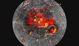
Mercury’s North Polar Region Acquired By The Arecibo Observatory Full Image and Caption A Mosaic of MESSENGER Images of Mercury’s North Polar Region Full Image and Caption Permanently Shadowed Polar Craters Full Ima...
PERTH, Australia, May 6, 2013 — (PRNewswire) — Mike Cunneen today announces EggMaps HD 1.05, an update to his popular #1-ranked navigation app for iPad that provides Google Maps at full-screen high resolution. Version 1....
 English
  Français
  العربية