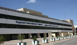
Dr. Mohamed AYARI, President of the Tunisian Association of Digital Geographic Information and President of the EuroArab Union of Geomatics, visited the Iraqi Republic from December 22 to December 30 2012. During this visit he ...
The 7th edition of geotunis which closed on April 12, 2013 in hammamet, drew the attention of international companies known in the oil sector, such as Shell, Tunisian Company of Petroleum Activities, Iraqi Oil Institution and o...
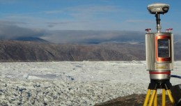
Sheboygan, Wisconsin, May 23, 2013 – AeroMetric announced the addition of a new High Accuracy Mapping Solution for its clients. The new solution is designed to obtain tight vertical accuracy and highly detailed imagery...
DETECTIONS OF BUILDINGSDIGITAL SURFACE MODELS DEFORMATIONS GENERATED FROM DRONES NADIR IMAGES Jean A. Doumit*, Souhail F. Awad*,Evgeny N. Kiselev** *Lebanese University, Faculty of Letters and Human Sciences, Department of g...
Dr. Mohamed AYARI, president of the Tunisian Association of Digital Geographic Information and president of the Euro-Arab Union of Geomatics visited Kurdistan on December 27 2012 where he met the president of the Association of...
Monitoring of Mosul Reservoir Using Remote Sensing TechniquesFor the Period After ISIS Attack in 9 June 2014 Lecture: Muthanna Mohammed Abdulhameed AL Bayati University of Technology – Baghdad- Building and Construction Dep...
S K AAl-Hummadi[1] N S Nuaimy[2] A L Ubaidy[3] 1Ministry of science and Technology, ,Remote sensing center, Iraq E-mail: shathamaster@yahoo.com 2Ministry of science and Technology, Remote sensing center, Iraq E-mail: ade...
Director General of The Royal Jordanian Geographic center Dr. Dean. Engineer Director General Ouni Hdhawna was chosen as a member of the scientific council of the international congress Geotunis 7thedition which will be held fr...
RIEGL goes for ultra-long ranges: VZ-6000 offers more than 6,000 m measurement range Horn, Austria, September 24, 2012 – Especially designed for ultra-long range applications in topograp...
 English
  Français
  العربية