Abstract
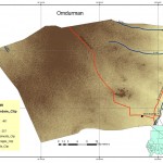
This research aims to map expansive soil (swelling soil) risk in Omdurman Locality. A soil that significantly changes its volume in horizontal and vertical planes with changes in moisture content which compromises the safety of building, bridges, roads above it.
Research assumes that risky expansive soil most likely located in areas where clay soils, lowest elevation and of underground water level close to the surface.
This research approaches to use GIS and remote sensing as methodology and source of most of the data. Using Arc GIS 9.0 weighted overlay tool.
Static Water Level in Well measurements, drainage map, soil map, and digital elevation model (DEM) data had been used as well as ground truthing to achieve accurate results,
This research had successfully concluded a risk map describes the degree of vulnerability or safety throughout the study area.
The research presented several recommendations, generally to take these results into account in future planning for the area, the importance of geotechnical research before embarking on construction as well as opening up to new construction technologies that enable adaption to a variety of situations.
Writer

Sali Abdul Aziz Sed Ahmad & Sawsan Hassan Bushara
Sali Abdul Aziz Sed AhmadDate, place of Birth : March 22,1981 SHARJA ,UAE
Gender : Female
Marital Status : Married
Nationality: Sudanese
Address :Fardous, Khartoum, Sudan
Education
Master of remote sensing & GIS
Sudan Academy of Sciences
Address Khartoum, Sudan
Session March 2006 - August 2008
Majors
Remote sensing ,GIS, photogrammetry , Remote sensing systems, disaster management ,environment impact assessment ,sustainable development ,GIS technical issue , Remote sensing and GIS applications in geology, geomorphology, hydrology ,water, soil ,agriculture ,land use ,forestry ,forest fire.
B.A .Hons. Geography
Bachelors Degree
. University of Alneelian
Khartoum, Sudan
Sep 2004
Work Experience
|
Sawsan Hassan BusharaPersonal Data:-
|
 English
  Français
  العربية


