Abstract
The environmental impacts of agriculture on water of the intensively cultivated areas has become of primary importance because of its consequences on the quality of surface and groundwater. In order to control and reduce the nitrogen pollution of water the European Union has obliged its members to define Nitrate Vulnerable Zones (NVZ) from which the outflow of nitrates from the agricultural sources should decrease. The aim of the performed research was to estimate the most endangered zones in Poland using multicriteria GIS analysis.
To model the agricultural nitrogen sources set of spatial data, in-situ measurements (National Water Management Authority) of nitrogen content in ground and surface water and anthropogenic point pollutant map were used.
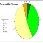
Using the CORINE Land Cover map the ratio between natural and artificial surfaces was calculated for each catchment. Next elaborated map for basins with soil map and DEM were used to define the terrain susceptibility.
In aim to calculate the possible nitrogen pressure on environment about 5000 points – for each spring and autumn period in 2005 – 2009, was employed. Measurements of nitrogen content in soil (at depth levels between 30, 60 and 90 cm) were used to define the relationships among the nitrates contamination and Nitrogen dose. Then taking into account the terrain susceptibility the risk areas of agricultural pollution were found. Most of them are situated in central, central-west and southern Poland.
Writer
Wozniak Edyta, Nasilowska Sylwia
| Prenom | Sylwia |
| Nom | Nasilowska |
| Entreprise | University of Warsaw |
| Profession | PhD |
 English
  Français
  العربية


