Abstract
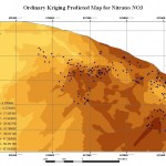
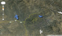
Spatial data analysis, remote sensing and Geographic Information Systems (GIS) were used to study the ground water quality in the A’Seeb area of the Sultanate of Oman. Groundwater samples were collected from 335 wells distributed in A’Seeb in the north-western part of the capital Muscat, Oman. The aim of this study was to identify the source of the water quality pollution, and characterize its expansion in the area. Spatial statistical analysis was used to visualize and explore trends (patterns) in the data and its spatial behavior. Remote Sensing and GIS Geostatistical modeling were used to map the water quality and relate it to the land use/land cover in A’Seeb. GIS map overlay was used to investigate and determine the relationship between water quality and other contributing factors such as the terrain, water drainage system, landfill leaching sites, and septic tank systems. The results showed that these factors have a direct impact on water quality deterioration. High nitrate (NO3) values were found to be closely associated with the populated or residential areas (where the septic tanks are used) and also closely associated with the drainage system that is affected by the landfill site in Al-Seeb. Analysis of ground water in A’Seeb exposed high levels of salinity in some areas as well as levels of some chemicals such as NO3 and electrical conductivity (EC) that exceed the Omani standards for drinking water. High NO3 values were found to be closely associated with the populated or residential areas (where the septic tanks are used). Very high values of EC were found to be concentrated in the farms areas. All wells in A’Seeb were found to be unsuitable for drinking water according to Omani standards
 English
  Français
  العربية


