9 July 2013

Using GIS for Highway Design: A Case Study

Abstract

Aline

Geographic Information System (GIS) is being used in various projects and research areas.
It has been widely used in a variety of applications for planning, presenting, and analyzing data
and results. Nowadays, many factors should be included in road design in order to preserve the
environment for example. Using GIS will help make road design less time and money consuming
while taking into consideration all important factors. Road design includes three steps:
planning, project development, and final design. In this study we will focus on the planning step
using GIS. GIS permits us to include factors such as endangered species and historical sites in
the planning process. Different factors can also be ranked according to their importance. A case
study is shown to demonstrate the proposed methodology. Land use and land cover maps are
used to define the factors with the demanded classification.

Writer

ALINE AYLO

ALINE AYLO ROAD AND TRANSPORTATION ENGINEER A) EDUCATION Fall 2008 – Fall 2010 University of Dayton (USA) - Master in Civil Engineering _ GPA 4.00/4.00 Fall 2003 – Fall 2006 Notre Dame University (Lebanon) - Bachelor of Geographical Information System _GPA 3.33/4.00 October 2001 –June 2005 IUL (Lebanon) - Bachelor of Surveying Engineering _GPA 80/100 B) PROFESSIONAL EXPERIENCES 1) JANUARY 2011 - PRESENT (AYLO ENGINEERING sarl) _Project Manager _PROJECTS: _Mayfouk project: Road design 30 km (Jaj, Lehfed, Mayfouk, Lebanon), Client: DGU _Hboub project: Road design 17 km (Hboub, Lebanon), Client: DGA _Alay project: Road design 30 km (Alay, Lebanon), Client: DGU _Amchit project: Road design 5 km (Aamchit-Lebanon), Client: Dar Al Handassa _Bikfaya project: Road design 1 km (Bikfaya- Lebanon), Client: Bikfaya Municipality _Byblos project: Subdivision, road design, excavation supervision and surveying works 1.6 km2 (Mechmech-Byblos- Lebanon) _Mar Chaaya project: Subdivision, road design (Mar Chaayah, Lebanon), Client: Blom Bank _Safra project: Subdivision, road design (Safra, Lebanon) _Kfertey project: Subdivision, road design (Kfertey, Lebanon) _Surveying works for Raed abillama architects _Surveying works for Kornet Chehwan Municipality _Calculation and comparison of the numerical model of the terrain for HOLCIM _Surveying works for Bureau Claude Jazzra _Conception and execution of a touristic map for Tripoli (Libya). Scale: 1/25000 _Settings out of divert projects 2) FALL 2010: _Optimal Loop Placement and Models for Length-based Vehicle Classification, Client: ODOT. _I-75 project: Road and interchange design (Dayton, Ohio), Client: ODOT _Teaching Assistant for the surveying course (CEE 213) _Research: GIS Safety Analysis System: A Case Study _Research: Exploring Risk Factors Affecting Urban Freeway Crash Frequencies   3) SPRING 2010: _Graduate Assistant: Optimal Loop Placement and Models for Length-based Vehicle Classification and Stop-and-Go Traffic _Teaching Assistant for the Highway Geometrics course (CEE 214)   4) FALL 2009: _Teaching Assistant for the surveying course (CEE 213) _Research: Analyzing the Safety and Operational Impacts of Installing Roundabouts in Ohio. 5) SUMMER 2009: _Teaching Assistant for the Field Surveying course (CEE 215) _Research: Analyzing the Safety and Operational Impacts of Installing Roundabouts in Ohio. 6) SPRING 2009: Graduate Assistant for the Highway Geometrics course (CEE 214) 7) FALL 2008: Facilitator in workshop for the first year engineering. 8) MAY 2006 - JULY 2008 ( BUREAU STEPHAN- LEBANON-HAZMIEH ) _PROJECTS : _Numerical model preparation of the terrain and rectification of the satellite imagery IKONOS. Classification of the vegetation- Operator on the ERDAS program. _Cartography: conception and execution of a touristic map for Tripoli (Libya). Scale: 1/25000- Team Leader. _Navigation map of GPS for the united emirates: Digitizing of the existent plan and the satellite imagery. _Surveying: Settings out of divers project-Calculation and comparison of the numerical model of the terrain-Team leader. _Digitizing of the cadastral plan for Lebanon: Quality control _Archeological site of Tyr (South Lebanon): Integration of the data to ArcGIS _Golf terrain: Designing of Golf court and modeling it on ArcScene(3D) 9) SUMMER 2005: Training GPS with engineer Joseph Nassif 10) SUMMER 2000-2004: Work on the field with surveyor Rizkallah Aylo- Operator 11) FINAL PROJECT (Notre Dame University): Ecological and Geological study of Palm Islands Nature Reserve- Lebanon (Application in ArcGIS Program) 12) FINAL PROJECT (IUL): Surveying of Palm Islands Nature Reserve-Lebanon C) CONFERENCE ATTENDED 1) MAY 2011: FIG- Bridging The Gap Between Cultures (Marrakech, Morocco) 2) JANUARY 2010: Transportation Research Board (Washington DC- USA) 3) SEPTEMBER 2001: First International Surveying conference(Unesco-Lebanon) 4) JULY 2003: Second International Scientific conference(Metropolitan Hotel-Lebanon) D) AWARD _University of Dayton Graduate Student Summer Fellowship 2010 Award _Dwight David Eisenhower Transportation Fellowship 2009 Award _University of Dayton Graduate Student Summer Fellowship 2009 Award E) PRESENTATION _Transportation Research Board 2010: Analyzing the Safety and Operational Impacts of Installing Roundabouts in Ohio. Session 516 _Transportation Research Board 2011: GIS Safety Analysis System: A Case Study F) LANGUAGES ENGLISH (Good) / FRENCH (Good) / ARABIC (Native language) / GERMAN (Classroom knowledge) G) SKILLS _USING OF: AUTOCAD, AUTOCAD CIVIL 3D, ARCGIS, ARCVIEW, LISCAD, ERDAS, HCS, SIDRA, SYNCHRO, and SAS. H) PROFESSIONAL SOCIETIES _Member of ITE student chapter _Member of Golden Key International Honour Society _Member of the order of engineers and architects (Lebanon) since 2006 I) ACTIVITIES _Member of the Red Cross First Aid Team (Lebanon) from 2002- till 2008 _Advanced Open Water of Scuba Diving (PADI) _Hobbies: Skiing, Camping, Swimming, Chess, Scuba Diving J) REFERENCES: Upon Request
Full Research


a4

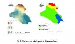
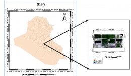
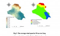
Selecting Suitable Sites for Wind Energy harvesting in Iraq using GIS Techniques

Selecting Suitable Sites for Wind Energy harvesting in Iraq using GIS Techniques  WEDYAN G. NASSIF1,2, DALILA ELHMAIDI1 , YASEEN  K. Al-TIMIMI2  1 Thermal Radiation Research Unit ,Faculty of Sciences of Tunis ,University  o...
by Lamouchi Helmi
0


a3

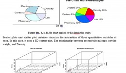
Machine Learning and Statically for Evaluating the Classification of Medical and Lab Services

Machine Learning and Statically for Evaluating the Classification of Medical and Lab Services Muna R. Harbi1,,Loay E. George2 1.Department of Physics, General Directorate of Thi-Qar Education, Ministry of Education, Thi-Qar, Ir...
by Lamouchi Helmi
0


a2

Study the characteristics and nature of the Indian dates tree. Tamarindus Indica L In the southwestern region (Jizan and Asir)

Study the characteristics and nature of the Indian dates tree. Tamarindus Indica L In the southwestern region (Jizan and Asir) Corresponding Author Mosaed Saeed Ali Alhader King Abdulaziz City for Science and Technology General...
by Lamouchi Helmi
0


AAAA

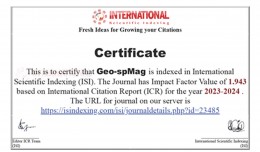
Geo-spMag Journal Achieves Impact Factor of 1.943 in ISI Indexing Geo-spMag Journal Achieves Impact Factor of 1.943 in ISI Indexing In a significant milestone for Arab scientific publishing, the international peer-reviewed jour...
by Lamouchi Helmi
0


2

Determine the morphostructure phenomenon, East Khor Al-Zubair by Space Imageries

Dr.TorhanAlmofti *                                         Ahmed Ibrahim Saleh Al-Naemi** Abstract Through the use of satellite data taken by the Landsat satellites a color phenomenon was...
by Lamouchi Helmi
0


1

Detection and monitoring crop of wheat and barley by using NDVI stacking technique and spectral angle mapper algorithm

S K AAl-Hummadi[1] N S Nuaimy[2] A L Ubaidy[3] 1Ministry of science and Technology, ,Remote sensing center, Iraq E-mail: shathamaster@yahoo.com   2Ministry of science and Technology, Remote sensing center, Iraq E-mail: ade...
by Lamouchi Helmi
0


2

Tunisian economy in the face of the Covid-19 pandemic: State of play, analysis and outlook

Bouzayani Rajab [1]/ Abida Zouheir[2] [1] Bouzayani Rajab : Faculty of Economics and Management of Sfax, University of Sfax – Tunisia. E-mail: bouzayanilazher@gmail.com [2] Abida Zouheir : Faculty of Economics and Mana...
by Lamouchi Helmi
0


Thumbnail.8.640.360

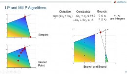
Reducing Total Freshwater Use in the Gold Processing Industry Using Linear Programming

Suliman Emdini Gliwan*1 Kevin Crowe *2 *1Ph.D.Candidate, Faculty of Natural Resource Management, Lakehead University, 955 Oliver Rd, Thunder Bay, ON, Canada (P7B5E1). *2Associate Professor, Faculty of Natural Resource Managemen...
by Lamouchi Helmi
0


06-731x413

Control of a Hybrid Wind-PV and Energy Storage System

Control of a Hybrid Wind-PV and Energy Storage System Mohammed Al Busaidi, Amer Al-Hinai*, Rashid Al-Abri, Mohammed Al-Badi Electrical & Computer Engineering, Sultan Qaboos University, Oman Abstract—Distributed energy gen...
by Lamouchi Helmi
0


images

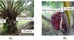
Modeling Ripeness Grading of Palm Oil Fresh Fruit Bunches through Image Processing using Artificial Neural Network

Modeling Ripeness Grading of Palm Oil Fresh Fruit Bunches through Image Processing using Artificial Neural Network Osama M. Ben Saaed1, Meftah Salem M Alfatni1,2*, Abdul Rashid Mohamed Shariff3 and Hadya S Hawedi1 1Faculty of I...
by Lamouchi Helmi
0


maxresdefault

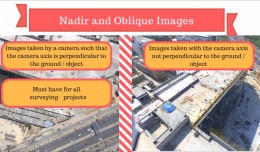
DETECTIONS OF BUILDINGSDIGITAL SURFACE MODELS DEFORMATIONS GENERATED FROM DRONES NADIR IMAGES

  DETECTIONS OF BUILDINGSDIGITAL SURFACE MODELS DEFORMATIONS GENERATED FROM DRONES NADIR IMAGES Jean A. Doumit*, Souhail F. Awad*,Evgeny N. Kiselev** *Lebanese University, Faculty of Letters and Human Sciences, Department of g...
by Lamouchi Helmi
0


Prezentacja programu PowerPoint

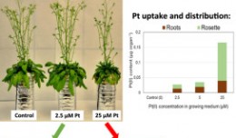
Comparative responses to cadmium toxicity of Arabidopsis thaliana mutant seedling (cad2) and wild type (col0)

Comparative responses to cadmium toxicity of Arabidopsis thaliana mutant seedling (cad2) and wild type (col0) CHAFFEI HAOUARI CHIRAZ1, SLATNI TARAK2, DJEMAL FATMA1, GOUIA HOUDA1 (Company / Faculté des Sciences de Tunis) 1Unive...
by Lamouchi Helmi
0


0 comments »


Be the first to comment!


Leave a Reply

Your email address will not be published. Required fields are marked *

*

* Copy This Password *

* Type Or Paste Password Here *

You may use these HTML tags and attributes: <a href="" title=""> <abbr title=""> <acronym title=""> <b> <blockquote cite=""> <cite> <code> <del datetime=""> <em> <i> <q cite=""> <strike> <strong>